
REVIEW · HELICOPTER TOURS
Mount Ruapehu Scenic Flight from Tauranga
See the North Island from above. This two-hour flight links Tauranga’s coast with Rotorua’s lakes, Lake Taupo, the Tongariro Crossing, and Mount Ruapehu in one sweeping trip. I like the wide range of scenery, from Te Puke’s orderly kiwifruit orchards to snowy volcanic peaks, and I like that the small aircraft gives the trip a personal feel. The pilot, Zac, was praised for pointing out local geography and explaining details such as the depths of Lake Taupo and Rotorua.
The main consideration is the aircraft’s age and size, which may surprise you at first. A small plane can feel less polished than a large sightseeing aircraft, though the reported ride was smooth and the mountain views were the clear highlight. At $1,194 per group of up to two, this is a special-occasion outing rather than a casual add-on.
In This Review
- Key points at a glance
- Taking off beside Mauao in Tauranga
- Crossing Te Puke’s kiwifruit country
- Rotorua’s lakes from a higher seat
- Looking into the Taupo volcanic basin
- Climbing 10,000 feet toward Mount Ruapehu
- Flying over the Tongariro Alpine Crossing
- Mount Ngauruhoe, the real-world Mount Doom
- The return to Tauranga completes the picture
- What the small aircraft means for comfort
- Is $1,194 good value for two people?
- Who should book this flight?
- Should you book the Mount Ruapehu scenic flight?
- FAQ
- How long is the Mount Ruapehu scenic flight?
- Where does the flight depart?
- What places can I see from the aircraft?
- How high does the flight climb?
- How much does the experience cost?
- How many people can join the flight?
- Is the flight wheelchair accessible?
- What should I bring?
- Can I cancel or pay later?
Key points at a glance
- A 10,000-foot climb toward Mount Ruapehu: The flight reaches the North Island’s highest mountain and its volcanic plateau.
- A complete volcanic circuit: You see Rotorua, Lake Taupo, Tongariro and Ruapehu in one two-hour outing.
- Mount Doom from the air: Mount Ngauruhoe, the film location for Mount Doom, is one of the trip’s most memorable sights.
- A small-group flight: The experience is limited to three participants, with the listed price covering a group of up to two.
- Coast, orchards, lakes and peaks: The route shows just how quickly New Zealand’s scenery changes.
- A flexible booking policy: You can cancel up to 24 hours before departure for a full refund and reserve now while paying later.
Taking off beside Mauao in Tauranga
The flight begins at 2 Dakota Way, with views of Tauranga Harbour and Mauao, also called Mount Maunganui. From the air, the famous coastal setting makes a strong opening: beaches, harbour water and the broad volcanic form of Mauao all appear before the aircraft turns inland.
I like this start because it gives you a clear sense of place. Tauranga is not just a launch point. Its harbour and beaches are part of the sightseeing, and the first minutes provide a useful contrast with the inland volcanic country ahead.
Aerial views also change your sense of scale. On the ground, Mauao feels like a landmark beside the city. From above, you see how it fits into the harbour and coastline. Keep your camera ready early, since the first views arrive before you have fully settled into the flight.
More Helicopter Flights in Tauranga:
- Mount Maunganui Scenic Flight: Departing Tauranga Airport
★ 5.0 · 1 review - Franz Josef Glacier: Helicopter Flight & Alpine Landing
★ 4.8 · 619 reviews - Franz Josef: 35min Helicopter Trip over Two Glaciers
★ 4.8 · 451 reviews
Crossing Te Puke’s kiwifruit country
The route passes over Te Puke, widely known as the kiwifruit capital of the world. The orchards form a neat pattern below, offering a very different view from the dramatic mountains later in the trip.
This section is valuable because it shows the working side of the Bay of Plenty. You are not looking only at postcard scenery. The organized rows of orchards explain part of the local economy and give the flight a stronger sense of the region.
The contrast also helps the rest of the trip. After seeing cultivated farmland and Tauranga’s coastal setting, the route moves toward the lakes and volcanoes of the Central North Island. You get a visual story, not a random collection of sights.
Rotorua’s lakes from a higher seat
The aircraft then heads toward Rotorua and its surrounding lakes. Rotorua is famous for volcanic activity, and the lakes are a reminder that this part of New Zealand was shaped by enormous eruptions and collapsed volcanic features.
From above, the lakes are easier to understand as a connected area. Shorelines, forest and open water create broad shapes that are difficult to grasp when you are driving between individual towns and viewpoints.
The pilot can add useful context during this part of the flight. Zac was specifically praised for explaining where places sit and discussing the depths of Rotorua and Taupo. That kind of commentary matters on an aerial trip, since a good explanation helps you identify what you are seeing rather than simply photographing it.
You might also see features connected with the Waikato River and Huka Falls as the flight continues toward Taupo. The falls were described as especially striking from above, while the Waikato River appeared immense. Exact visibility depends on the route and conditions, so treat these as possible highlights rather than guaranteed passes.
Looking into the Taupo volcanic basin
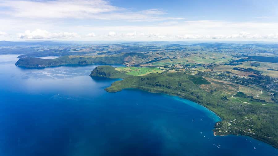
Lake Taupo is one of the major sights on the route. It fills the crater of the extinct Taupo Volcano, and its great size becomes much clearer from the air than from a single lakeside viewpoint.
The lake is linked to one of the biggest volcanic eruptions in recorded history. The eruption was said to have been visible as far away as Europe, a reminder that the Central North Island has not simply been shaped by small, quiet volcanic cones.
I like this part of the journey for its scale. Rotorua’s lakes feel varied and contained, while Taupo appears broad and powerful. The flight lets you compare them in one afternoon, with the pilot’s explanation helping you connect the water below to the region’s volcanic past.
The aerial angle also makes Huka Falls worthwhile. From the ground, you focus on the rushing water and viewing platforms. From the plane, the falls and river can be understood as part of a much larger drainage system.
A few more to weigh up in Tauranga
- White Water Rafting – Kaituna Cascades, The Originals
★ 5.0 · 1,274 reviews - Tauranga Shore Excursion: Rotorua Highlights
★ 4.5 · 427 reviews - Tauranga: Evening Glowworm Kayak Tour
★ 5.0 · 311 reviews - 6.5 hour Small-Group Rotorua Naturally Shore Excursion – Tauranga
★ 4.5 · 283 reviews
Climbing 10,000 feet toward Mount Ruapehu
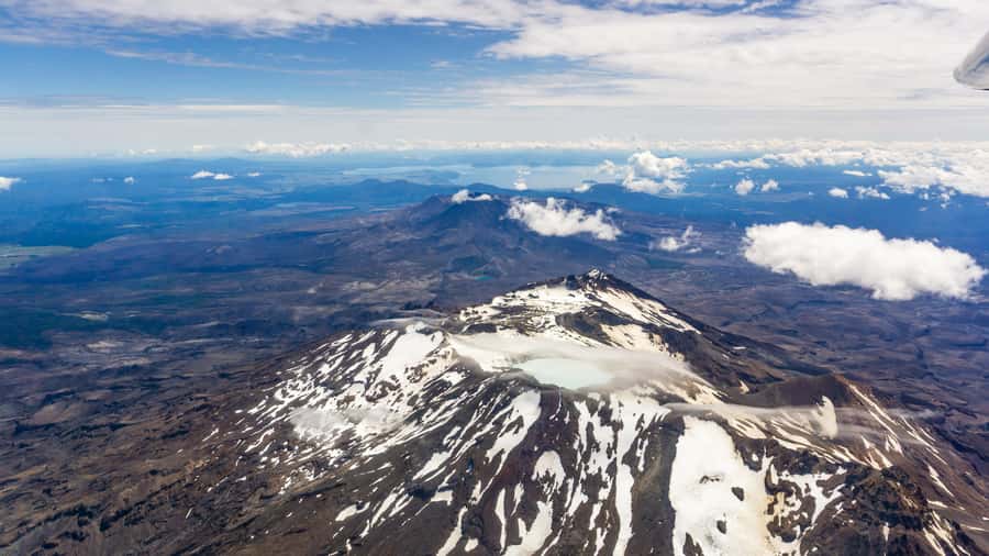
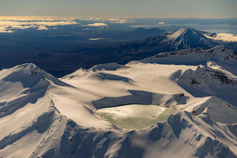
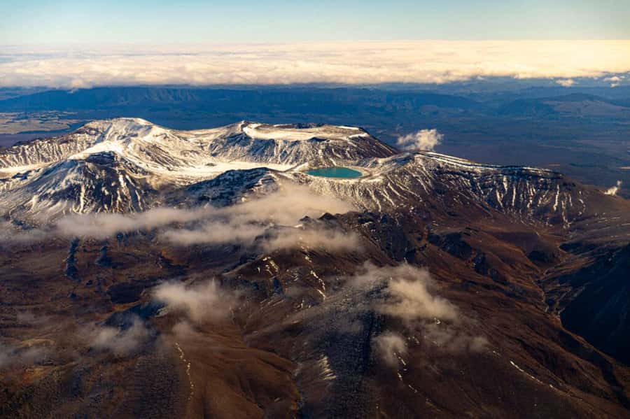
The dramatic portion begins as the aircraft climbs toward Mount Ruapehu. The flight reaches about 10,000 feet, bringing you to the volcanic plateau around the North Island’s tallest mountain.
This is where warm clothing becomes important. Even if Tauranga feels mild at departure, the aircraft will be operating at a much higher altitude, and the mountain section is the reason to bring a jacket or other warm layers. Sunglasses are also useful in bright conditions, especially when looking toward snow or pale volcanic rock.
Mount Ruapehu is an active volcano, so the views come with real geological importance. You may see its crater lake and the broad volcanic area around it. The mountain is not merely a scenic peak. It is a living part of the North Island’s volcanic zone.
The height gives you a strong sense of the mountain’s scale. Roads and walking tracks below become small marks, while ridges and volcanic slopes stretch across the view. If you want close-up photos, keep your camera accessible rather than packed away.
One practical point: visibility controls the experience. Clear weather is especially important for distant volcanic peaks, crater details and the Tongariro area. The flight remains scenic in mixed conditions, but cloud can hide the very sights that justify the fare. Check the forecast and bring clothing suited to changing weather.
Flying over the Tongariro Alpine Crossing
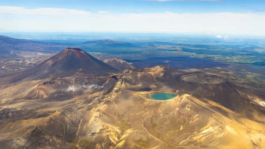
The route passes over the Tongariro Alpine Crossing, one of New Zealand’s best-known day hikes. From the ground, the crossing takes hours of walking and careful planning. From the air, you can see the volcanic route as part of a much larger setting.
This aerial view is useful even if you plan to hike the crossing later. It gives you a map-like understanding of the area, showing how the track moves through volcanic terrain and how the peaks relate to one another.
If you have already walked the crossing, the flight offers a different way to revisit it. You may recognize the volcanic forms, crater areas and ridgelines, though the exact details depend on visibility and the aircraft’s position.
If you have not done the hike, the flight does not replace it. You will not experience the walking, weather changes or physical effort of the crossing. Instead, you get a compact overview that helps you decide how much time the area deserves on another day.
Mount Ngauruhoe, the real-world Mount Doom
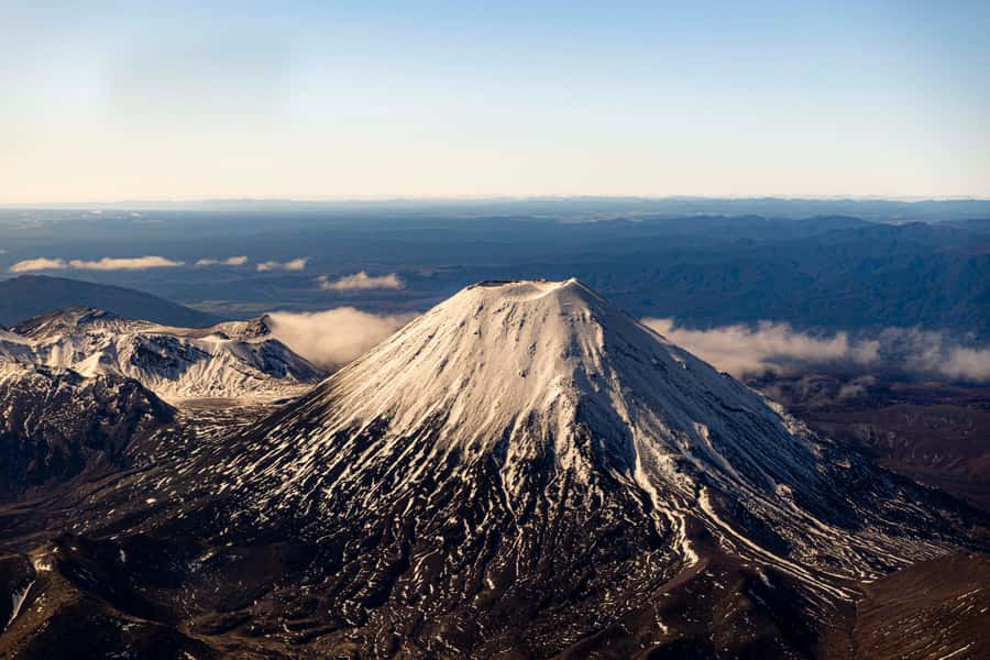
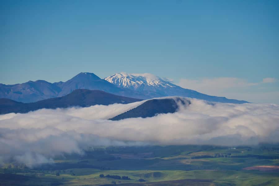
Mount Ngauruhoe is one of the biggest reasons film fans book this flight. Its volcanic cone was used as the setting for Mount Doom in The Lord of the Rings, and seeing it from the air gives the peak a dramatic context that ground-level views may not provide.
The film connection is fun, but the mountain is worth seeing even if you are not interested in the movies. Its shape is instantly recognizable, and its position among the surrounding volcanic peaks makes it one of the clearest symbols of the region.
Do not expect a theme-park presentation. This is a flight over a real active volcanic area, with natural scenery taking priority. The Mount Doom link is one detail in a broader trip that includes geological features, lakes, forests and high mountain terrain.
For photographs, the aircraft’s windows and changing position matter. You may not get a perfect frame every time, so take several images and spend some time simply watching. The most memorable part may be the relationship between Ngauruhoe, Tongariro and Ruapehu rather than one isolated peak.
The return to Tauranga completes the picture
After the mountain section, the flight returns toward Tauranga. This gives you a second chance to take in the changing scenery and connect the different regions you have crossed.
The route works well as a loop because no single view has to carry the whole experience. You begin with harbour and beach scenery, move through orchards and lakes, reach high volcanic country, and then return to the coast.
That variety is the flight’s strongest feature. If you only want a close look at Mount Ruapehu, a shorter mountain-focused flight might be more efficient. If you want to understand the Central North Island as one connected area, this two-hour circuit offers much more.
What the small aircraft means for comfort
The experience is limited to three participants, which keeps the flight personal and avoids the feel of a large sightseeing operation. You should have a better chance of hearing the live English commentary and asking about the places below.
The trade-off is the aircraft itself. One passenger was initially concerned by its size and age, although the flight proved smooth. That is useful advice: do not expect a glossy cabin or a commercial-airline feel. The reward is a more direct, intimate way to see the region.
The aircraft’s size may also affect how easily you photograph. Window views are central to the experience, and you will want to keep your camera ready. Bring sunglasses, warm clothing and weather-appropriate layers. Smoking, alcohol and drugs are not allowed.
Wheelchair access is listed, which makes this option more workable for some people who cannot manage a long volcanic hike. Still, if you need specific assistance, confirm the arrangements before booking, since the supplied details do not explain the aircraft’s exact boarding setup.
Is $1,194 good value for two people?
The price is $1,194 per group of up to two people. That works out to $597 per person if two people share the booking, a high cost but not an unreasonable one for a private-feeling flight covering such a large section of the North Island.
Value depends on what you want to see. You are paying for access to a route that would take far longer by road, plus aerial views that ground transport cannot provide. In two hours, you can see Tauranga, Te Puke, Rotorua, Taupo, Ruapehu, Tongariro and Ngauruhoe.
I would consider it good value for a couple celebrating a special occasion, photographers seeking a broad range of scenery, or anyone with limited time who wants a strong overview of the volcanic center of the island. It is harder to justify if you are on a tight budget or already planning several mountain and lake viewpoints by car.
The listed price covers up to two people, while the activity is described as limited to three participants. If you want to bring a third person, check how the operator applies the group price before paying. That small detail could affect the final cost.
Flexible booking improves the value slightly. You can reserve now and pay later, and cancellation is free up to 24 hours before departure. Starting times depend on availability, so check the schedule before building the rest of your day around it.
Who should book this flight?
I would recommend it to you if you want maximum scenery with minimum physical effort. The flight suits couples, small groups, film fans, geology enthusiasts and anyone who wants to see the North Island’s main volcanic sights without spending a full day driving.
It is also a good choice if the Tongariro Crossing interests you but a long hike is not practical. You can see the route and volcanic peaks from above, though you should not think of the flight as a substitute for walking it.
Families may appreciate the short duration and small group size, but the high price means the experience needs to be a priority for everyone in the group. People who dislike small planes should consider that carefully, especially after hearing that the aircraft may look older than expected.
Book with realistic expectations. This is not a luxury aircraft experience with a polished cabin. It is a practical scenic flight, guided by a pilot who can explain the geography while you watch it unfold.
Should you book the Mount Ruapehu scenic flight?
Book it if you want one memorable aerial circuit linking Tauranga’s coast, Rotorua’s lakes, Taupo’s huge volcanic basin and the mountains of Tongariro National Park. The strongest moments are likely to be the climb toward Ruapehu, the view of its crater lake and the sight of Ngauruhoe, the real-world Mount Doom.
Skip it if the price feels too high for a two-hour activity, if you need a large aircraft, or if your main goal is to spend time on the ground at one mountain. For everyone else, this is a powerful way to understand how the North Island’s coastal, agricultural, lake and volcanic regions fit together.
FAQ
How long is the Mount Ruapehu scenic flight?
The scenic flight lasts two hours.
Where does the flight depart?
It starts at 2 Dakota Way in Tauranga.
What places can I see from the aircraft?
The route includes Mauao and Tauranga Harbour, Te Puke’s kiwifruit orchards, Rotorua’s lakes, Lake Taupo, Mount Ruapehu, the Tongariro Alpine Crossing and Mount Ngauruhoe, also known as Mount Doom.
How high does the flight climb?
The aircraft climbs toward Mount Ruapehu at about 10,000 feet.
How much does the experience cost?
The listed price is $1,194 per group of up to two people.
How many people can join the flight?
The activity is described as a small group limited to three participants. The listed price covers a group of up to two, so confirm the price for a third participant before booking.
Is the flight wheelchair accessible?
Yes, wheelchair accessibility is listed for this activity.
What should I bring?
Bring warm clothing, sunglasses, a camera and clothing suitable for the weather.
Can I cancel or pay later?
You can cancel up to 24 hours before departure for a full refund. You can also reserve your place and pay later.
Just added in Tauranga
- Tour of the Bay, Te Puna Sculpture Park and Historic Village★ 4.3 · 3 reviews
- Tauranga: Waimarino Adventure Park Supreme Pass Entry Ticket★ 3.8 · 6 reviews
- Tauranga: Daytime Scenic Lake McLaren Kayak Tour★ 4.6 · 16 reviews
- Tauranga: Rotorua Redwoods Tour & Maori Village Experience★ 4.9 · 8 reviews
- Tauranga: Kiwifruit Destination and Sights Shore Excursion★ 4.8 · 69 reviews
- Tauranga: Evening Big Kanu Glowworm Tour★ 4.2 · 34 reviews
- Tauranga: Mount Maunganui Harbour Sightseeing Cruise★ 4.2 · 89 reviews
- Tauranga City & Scenic Sightseeing 2-hour Local Tour★ 4.3 · 47 reviews
Helicopter Tours, compared.
Franz Josef Glacier: Helicopter Flight & Alpine Landing
Read our review →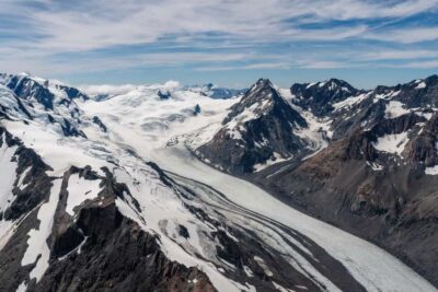
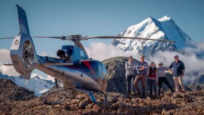
Mount Cook: Scenic Helicopter Flight with Alpine Landing
Read our review →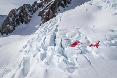
Franz Josef & Fox Glaciers Helicopter Flight & Snow Landing
Read our review →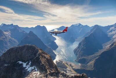
Milford Sound Small Group Tour from Queenstown with Scenic Flight
Read our review →
2.5 Hour Glacier Hike with Helicopter Transfer
Read our review →
Fox Glacier: Up to 3 Hours Hike with Helicopter Transfer
Read our review →
Pilot’s Choice Helicopter Tour & Alpine Landing
Read our review →Browse the lists this tour appears in